- Home
- Lake Powell, Utah
- Broughton Islands
- Barkley Sound, Vancouver Island
- Blog: Barkley Sound, Vancouver Island
- Desolation Sound
- Blog: Desolation Sound, British Columbia
- Princess Louisa & Gulf Islands, British Columbia
- Blog: Princess Louisa & Gulf Islands, British Columbia
- Great Loop Part 1, Chicago to Mobile Bay
- Blog: The Great Loop, Part 1, 1600 miles of River Boating. Updated 11-6-10
- Getting Boarded & Inspected
- Boating With Boots, the cat
- Checklist & Instructions
- Living in the World of 12 Volts
- Making Use of Smaller Spaces
- Ah, the Head & Shower
- Trailering and Camping with the Tug
- Tools & Cleaning Materials
- Trailering & Insurance: When bad things happen
- The Last Chapter
- About Us
- Contact Us
Wilderness Boating in the Desert
Lake Powell is part of the Glen Canyon National Recreation Area and is the lake behind Glen Canyon Dam in southern Utah and parts of it straddle the Utah-Arizona border. The lake is the Colorado River. It is remote with few communities and fewer services. The National Park Service is the primary agency but shares jurisdiction with the states of Utah and Arizona, the Navajo Nation and the counties that the lake goes through. The primary business presence on the lake is Aramark who operates the concessions plus there are several houseboat rental operations.
What You Need to Know If You Go
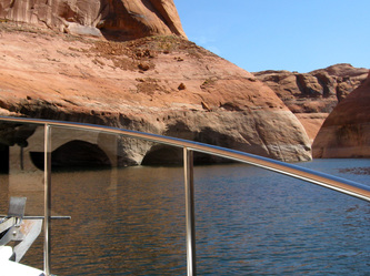
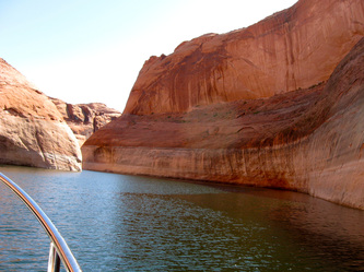
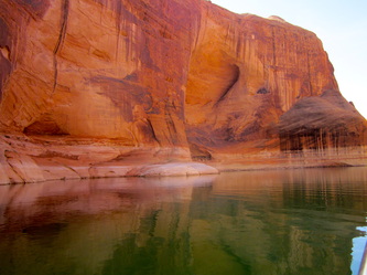
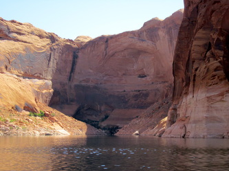
Its Incredible. The scenery is breathtaking and ever-changing with different light. Though there are challenges, the trip is worth the price of admission. What you see on the way up a canyon is not the same when on the same route when returning. This is not your typical lake. It has a main stem that is over 150 miles long but there are scores of canyons on each side that call out to be explored. Some of the canyons can be miles in length and narrow down to only several both boat widths. The canyon walls can be hundreds of feet high. The water depth is frequently in triple digits.
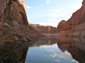
The Lake has different characters and moods that correspond to the seasons and the time of day. Memorial Day to Labor Day is extremely busy with many boaters; personal watercraft, water skiers, and go-fast boats-generally all based out of houseboats. Before May 15 and after September 15, miles may go by without seeing a boat and you can enjoy miles of canyons alone. As the day progresses, the mood of the lake changes. Mornings can be calm, the water is a mirror and wildlife is heard or seen. The heat of the day builds through the late morning and starts to ease in the early evening. The nights can be still and silent with the sky ablaze with stars.
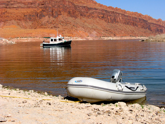
The National Park Service doe not coddle boaters. There are only three marinas and they are 50 miles a part. Diesel is only available at Bullfrog and Wahweap, so you have to plan according. Fresh water is available at both of these and at Dangling Rope Marina. There are virtually no docks for overnight moorage, no mooring buoys, no hookups and no designated anchorages; you have to figure it out along the way. Simply, mastering the technique of anchoring is essential. If you are not going to beach your boat, and we did not, carrying a dingy is essential. Plan on being self-sufficient on the boat's electrical system for days.
Ramps: Two at Wahweap, one at Antelope near Page, Arizona, and another at Bullfrog are the common ones. We used Bullfrog and recommend it because it is located in the higher bluff area of the lake. But, the road in and out of Bullfrog has some of the steepest grades and turns that we have ever encountered. If you go, take it easy and moderate your expectations accordingly.
Weather: Prepare for the temperatures that can include a long thermometer. Winds can up in the afternoon, build to double digits and come from many directions.
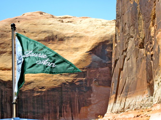
Pump-out: Discharge in the lake is wrong and illegal. There are many opportunities pump-out but You must have the right pump-out fitting that fits your deck fitting. The Laurie Ann has an 1- 5/8" fitting. The marinas sell the fittings for over $20 each.
Invasive Species Inspection: Every boat is inspected before launching. If you arrive and launch when the inspection station is closed (check on those hours) a hefty fine is possible.
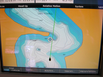
Technology: A must is a chart plotter that has the depth details, rocks and canyons. The passages through the canyons may be elusive and the chart plotter will be comforting. Cell phone and data coverage is spotty unless you can see the one antenna on the high bluff.
Books and Maps: We used the Stan Jones map, a map by National Geographic available at REI, and Boater's Guide to Lake Powell by Michael Kelsey - if you can handle the 8 point font. Be ready for the lack of information at the lake.
The Decision To Go
We had at least 25 good reasons not to do this trip, ranging from things at home, projects to do, and host of work related tasks. It is really easy to be lazy and not go. The mileages on the map can be daunting, the cost of fuel for this 1,300-mile expedition to a remote portion of southern Utah is flat-out discouraging. But you do this trip because it is Lake Powell where everyone who spent any time there has an emotional reaction, an excitement coupled with a yearning to go back. We wanted to join that elite group of boaters who make the pilgrimage to Lake Powell.
Getting There
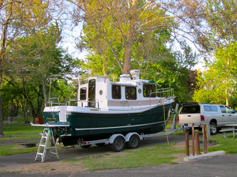
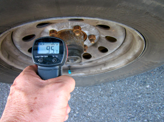
From our home base near Seattle, the drive is about 1,300 miles and we did it in three days staying at state parks or KOA's along the way. The boat's head is easy to use by using the shower head to put in water. At every stop, the trailer's hubs are check for problems by using a laser pyrometer as excessive heat is often the first indicator of problems.
Wednesday, May 9
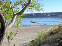
We arrived in Bullfrog at about 4:30 PM enduring a harder drive that we expected. I-70 from Salina was difficult with the grades but the road construction narrowed the lanes and missing the huge orange barrels was more a matter of luck than skill. But the final 40 miles to Bullfrog was a surprise with grades of 8% both up and down and tight curves. Whoever placed the road on this route was really the low bidder.
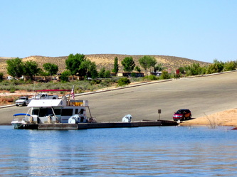
We missed the turn-off to the boat ramp after finding the Visitor Center closed; it had not opened yet for the season, something we had never encountered before. Information was hard to come by for two people who pride themselves in the ability to figure things out. When we found the boat ramp, it was huge but limited. Only two finger piers. Most people got out of the boats on a pier and while they brought down their trailer, another person on the boat would run it up on the trailer. Do-able for most but that will not work for us.
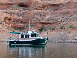
After this information gathering, we settled down to outfit the tug. Putting up fenders, canvas, and stern lines, inflating the dingy and putting that whole package together on the swim step. Moving Boots, our cat, in to the boat; all at the hottest time of the day-it was 92 degrees. The tug was easily launched and she came to life with one turn of the key. In a few minutes, we nudged into the fuel dock and found it closed. We did not need fuel for we had got it in Green River and saved 75 cents a gallon; the tank took 60 gallons. We needed information, ice and a bit of gasoline for the dingy.
A private marina to the south was explored and two people on mammoth houseboats told us to tie up at a space without a green card. The marina office was shut down for the day. We tied up, took measures to cool off and celebrated our first night at Lake Powell with a dark beer from Maui. Cell phone coverage is adequate and Internet coverage is weak, email but nothing more.
Thursday, May 10
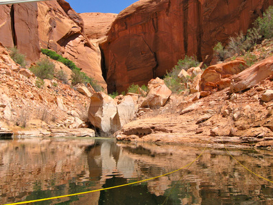
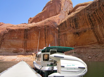
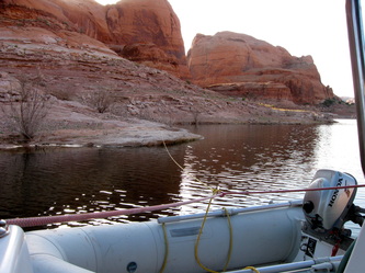
The yellow line is the tug's stern tie line. It was used at every anchorage.
Blazing blue skies and the boots of fisherman on the dock woke us up. When the marina store opened, the slip fee was paid ($30). The concession services have new employees that started this week, a sign that the tourist season is beginning to accelerate. You have to be patient with the new employees who have that shine of just finishing their customer service training but have not learned how to run the cash register; awkward smiles and genuine apologies. We bought the Stan Jones map of the lake for $4.99 and it became one of the three sources of information we used for this trip. A shuttle came to take us to the Post Office but the driver said it did not open until 10 AM. A 90-minute wait was not in our plans, so we opted to do the mailing on another day and left the marina at 8:30 AM.
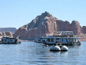
Heading north, up lake, passing the floating fleet of privately owned houseboats swinging on mooring buoys, and the ferry at Halls Crossing, the boat traffic was light and the lake was flat with temperatures in the low 70’s. We cruised along at 8 MPH, sipping fuel, passing the occasional houseboat and being passed by the occasional go-fast AWB or average-white-boat and there were jet skies, bass boats, and aluminum pontoon boats.
The red and green buoys on this lake do not have their traditional meaning of marking the sides of the channel; these are placed at nearly the center of the lake and have the mileage as measured from the Glen Canyon Dam. So, the buoy at Bullfrog is number 95 or 95 miles from the dam at Page, Arizona. Like most buoys elsewhere in our travels, they do not necessarily correspond to the location of them on the chartplotter. We view the electronic location of the buoy on the chart as only advisory.
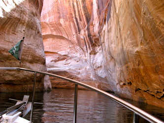
Our first exploration was the Moki or Moqui Canyon. Here, we discovered the depths to remain in triple digits, but the distance between the canyon walls would be in double digits and narrowing. High, sheer walls with tight turns would conceal the path of the canyon; every turn revealing a new discovery of color, shape and texture of the rock. The tug was nearly idling along as we traced the canyon back for over a mile to its head, looking for the ruins and petroglyphs left behind be a civilization over 700 years ago. We were awed.
Heading on up lake, we sped up to 12 miles per hour to cover some distance and to clean out the turbo charger. In the 65-degree water and the 75-degree air temperature, the coolant temperature slowly rose until leveling off at about 208 degrees. A Ranger 21 with Utah registration was going the opposite direction. We waved and they waved back.
Forgotten Canyon beckoned us to explore its treasures. Again, there were sheer, high walls and very deepwater. Turning and twisting, watching the depth sounder and learning that the depths on the chart plotter were about 10 feet less than reality because the lake level is high. The sun was rising, high in the sky and the temperature was in the high 80’s, it was time to stop and settle in.
At Knowles Canyon, near buoy 107 we went to the head of the canyon and found a houseboat had gotten the best spot, heading back, we found good anchorage in the arm on the starboard side and dropped the Danforth in 20 feet of water. The swing room was too narrow, so the stern-tie line was deployed using the dingy, put around a rock and brought back to the tug. When both the anchor line and the stern-tie line had some tension, we were locked into place; which was useful because during the night the breezed freshened, changed directions and pushed on the tug.
All measures to mitigate the sun and the heat were employed: shades, canvas, curtains, 12-volt fans, neck coolers, and a cockpit rinse off using the shower hose through the porthole. Laurie digested all the available information on Lake Powell and I did 3 billable work hours. Dinner was tacos and taco salad and the evening was concluded with a movie on the laptop.
Friday, May 11
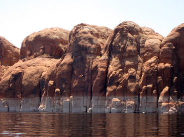
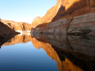
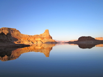
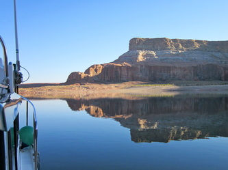
The morning sun on the canyon walls was glorious with a reflection on the still lake waters. By 8:30 AM, the stern-tie was reeled in, the dingy raised but the anchor resisted being brought aboard. The windlass worked but the rode was tight and not moving. Changing angles, letting the tug’s engine power in idle pull on the line eventually freed the rode. The line came up stained brown like it had been around a log. Once it came up the anchor was free.
We headed back down-lake, deciding that more places to explore were toward the dam. The tug cruised smoothly along in the calm water at 8 MPH at 2,000 RPM’s and the autopilot was used on the long and straight portions. We kept to the shady side of the lake taking in the changes of color, light and shadow, curves and texture in the enormous rock features.
By 10:30 AM, we were back at the Bullfrog Marina where Laurie hopped into a free shuttle van for the 1-½ mile trip to the Post Office. She found a talkative driver who had been working for the concession for three weeks, lived in Utah and showed the housing facilities for the college-aged employees (a big dormitory) and another housing area for the older employees. My job was to fill up the water tank, download email, check for voice mails and do the pump-out of the holding tank.
All went smoothly except the pump-out. I learned that there is no marine industry standard for pump-out fittings. What we have in Puget Sound does not work on Lake Powell but I was able to cobble together a solution from some fittings that are kept on board. Then, the pump would not work. The new employee did not have the solution and the new supervisor said the guy who knows all about this is not available. Again, there were awkward smiles and genuine apologies. I understood completely having been there a couple of times.
When Laurie returned, we idled over to the pump-out dock that the National Park Service maintains. There, everything worked fine and the dastardly deed was done.
Heading down-lake, the next canyon that was explored was the Lost Eden Canyon. This was a short one, with lower walls, narrow and the water was choppy that was caused by the jet skis and powerboats ahead of us.
Then, Annie’s Canyon was explored at mile 84. The light made this canyon a great gift to explore. We idled along, through triple digit depths, marveling at the splendor and grandeur of the rock walls. Boating so closely to these high walls was remarkable. The danger is not depth, it is making contact with the walls; but a constant watch was kept on the chartplotter because it had markings of hazardous rocks. Both of these canyons are for sightseeing, not for anchoring or going ashore.
The lake twists and turns and does not easily reveal the path to be taken until a turn is completed. The Ranger 21 that was seen yesterday came around a bend upon us. They responded to our radio call and said they were from Utah and volunteered the one place not to miss was Davis Gulch. The walls and cliffs were high above us and the solid walls transitioned to groups of walls with low hills between them. Sometimes, the groups of rising rock resembled a face or an animal. A large group looked the toes of a giant. Our imaginations went wild.
In the mid-afternoon, we turned into The Rincon at mile 77, looking at several small bays as sky warned of a frontal system coming from the southwest. Just as the anchor was dropped and set at the northern portion of the bay the wind began to rise from the southwest. The towering butte of The Rincon provided some protection. Soon, white caps were seen on the wider portions of the lake, but not in our small cove. The anchor was dropped in 20 feet of depth and 60 feet of rode was played out. The weather radio spoke of thunderstorms with locally gusty winds.
First, the wind came from the southwest, then switch to the south east and I looked at the rocks about 100 feet away from the tug’s stern and thought about re-setting the anchor because if the wind increased, the rode would be let out another 40 feet. Then, the wind shifted to the east and the tug’s stern was 30 feet away from the opposite shore. The Danforth anchor was turning, sliding and re-setting as the wind shifted. The wind rose to a sustained 15 knots with gusts to 25 or 30 knots. To reduce the number of variables and to stabilize the boat in the shifting wind, the stern-tie was rolled out, put around a rock and brought back to the transom cleat. But within an hour, the anchor dragged, causing us to scramble to start the engine, remove the stern-tie line, raise the anchor, re-position the tug, re-set the anchor and re-do the stern-tie line. All of this was accomplished in 10 minutes and just as the sun was setting. We watched in twilight the reference points in the distance to make certain that the tug did not move; the anchor was set.
The wind eased by 9:00 PM and it was quiet night, the clouds blew away to reveal a star-filled sky.
Saturday, May 12
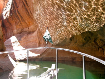
The Cathedral in the Desert
After a nice breakfast of eggs, we took an hour-long stroll along the north edge of The Rincon, following cattle trail, ATV tracks and the occasional rock piling that traditionally marks trails. The heat was building by 9:00 AM to past 75-degrees. At 9:30 AM, the anchor was pulled and we idled around the large bay and decided that we had chosen the best location for the minor blow.
Long Canyon was the first canyon explored. Our comfort levels for the closeness of the walls, the tight turns the ever-concern of the rock you could not see was better. We were no longer Lake Powell new-bees. After leaving, the tug was powered up to its fast cruising speed of 12 MPH because there were no canyons to see along this stretch. The boat skated along on the flat water and windless morning under clear blue skies, turning to port and starboard as we followed the buoys and the depth was always in triple digit depths.
Six miles later, a turn to starboard brought the Escalante River Arm. This arm has many canyons. The main stem goes for miles and is worthy of more than just a few hours of exploration. Laurie had digested a lot of information and one of her talents, while traveling, is to have an intuitive feel for a place. Clear Creek Canyon clearly called her and it was also billed as the "Cathedral in the Desert" and was the most photographed; it was all of that and more.
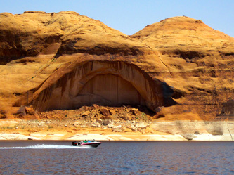
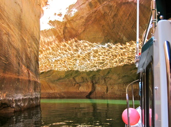
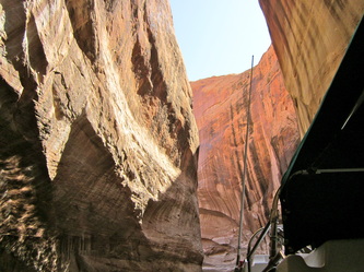
To set the stage, the elevation of the hills, rocks, walls and features was lower, opening the horizon to more sky. It was quiet and we were the only ones in the canyon. Some time after entering the wide mouth, the channel narrowed and heavy, huge, and round features of gray rock surrounded us. Narrowing further, the vertical walls rose and began to close in, squeezing out the sky. The walls rose in height, so much so that the GPS alarm went off indicating that the signal from the satellites was gone. Then the sky was gone, as we rounded a bend and entered a cave-like feature where light reflected off the water and danced in silvery patterns on the sandstone above us. The light changed a band of water to aqua green and it arc staying parallel to the walls. We could touch the walls. It was a holy place that affected the spirit and dazzled the eye. Never in danger of striking the walls, we ran out of room. The tug was turned around and we idled out, thankful for the opportunity to see this incredible place.
The next canyon was Davis Gulch. We slowly went up the twisting, winding canyon and continued on after the chart plotter showed we were on land. Actually, there was still 60 feet of water under us but there were sections where the width would prohibit two boats from passing each other. We came to Lagorce Arch, and passed underneath; it is not a bridge that spans the river, but rather an arch formed by eroding earth in the rock wall and leaving an arch shaped excavation. At the next widest point, probably two miles from the beginning of this canyon, we turned around.
After leaving the Escalante River Arm, the story of the Hole-in-the-Rock caused us to stop and look. The story was of wagons, families, and livestock who sought a shortcut through the desert. They locked the wheels of the wagons and by rope, let them down the hundreds of feet of steep slope to the canyon floor. We look at that feat and were impressed with their determination, courage and leadership that must have been required to keep this group together.
At mid-afternoon, we are searching for anchorage, checking out Register Rock and then finding a suitable place in Cottonwood Cove. Entering the cove brought an image of what Glen Canyon must have looked like before the dam and the lake. Just before the cove, the lake’s depth is nearly 300 feet. At the cove’s edge, the depth is suddenly 50 feet and revealed there was probably a 250-foot high waterfall here 50 years ago. At nearly the end of the cove, the anchor was dropped in 18 feet of water and set on the second try. The tug was stern-tied to the shore. We opted to manage for sun and heat rather than wind and put the bow to head west and looking down the cove.
After a rinse off in the cockpit to cool down in the low 90’s sunshine, the wind picked up from the northwest. Must be a trend, wind blows at 10 to 15 and gusts to 25 MPH. After dinner, the dingy ride to the head of the cove showed a path to a huge feature called an amphitheater. The long light in the last two hours of the day often makes the best photography.
Sunday, May 13
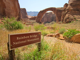
Sacred ground and one of the wonders of the world
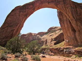
We motored out at 9:30 AM, heading down-lake toward Forbidding Canyon and Rainbow Bridge. Deciding not do any side trips into any number of great canyons, we pressed on for 12 miles to mile marker 49, arriving at about 11:30 AM. The canyon’s entrance was non-descript given that that this was the only plausible way to see “one of the seven wonders of the world.” A huge natural bridge, nearly 300 feet high and long, it is sacred ground for the Navajo’s and the topic of many debates on protection versus use over the past 50 years.
When the canyon forked, a very small floating National Park Service sign announced the start of the Rainbow Bridge National Monument. Then, the canyon narrowed greatly and we wondered how the tour boats that come at least twice a day from Page, Arizona could do this. Twists and turns, waters shaded by high, smooth walls of sandstone, and no other boats; we were entering a scared place. Before the lake, the journey was done in days over miles of rafting a wild river and then a severe trail. Now, it is only a couple of hours from the dam by boat. I wondered if we appreciated it as much as they did.
The last turn revealed a very long dock that had designated spaces for two large tour boats and the remainder could probably accommodate 25 small cruising boats. Today, the sole tour boat was loading to leave as we arrived and there were two AWB’s (average white boats) docked. We docked in the shade caused by the high canyon walls. 100 feet away, the park service had provided a floating bathroom for the hundreds of visitors that come on a summer’s day. Today, we saw 6 other people and no ranger, no visitor center, no programs, and no entrance fee. The long dock turned to the south and continued another 150 feet to a ramp that went to the dirt trail. The magnificent natural bridge, really a huge arch of sandstone came into view. An easy ¼ mile walk and the trail ended to discreet signs of area closed and please respect sacred ground by not walking under the Rainbow Bridge.
Back at the tug, lunch was prepared and served and Boots finally put her paws on something other than the tug. A raven, nearly as big as Boots, set down on the dock startling everyone. Heading out, we thought about how boaters must handle the two-way traffic in these narrow waterways, where the sharp turns provide little warning and there is no suggested speed limit, so the idiots have permission to put everyone in jeopardy.
We were looking for an early stop for the day and settled on Mountain Sheep Canyon after looking at two other possibilities. We set the anchor in 30 feet of depth and stern-tied to a rock that was nearly in the middle of a small cove and settled down to work some billable hours and read. When the wind rose, the Danforth dragged on the Navajo smooth rock bottom. We set it again but did not like the ultimate distance to the shoaling edge. At 6 PM, we pulled everything and powered out of there, taking a quick look-see at Dangling Rope Marina where there was no overnight docking and headed to Cornerstone Canyon at mile marker 42.
We dropped anchor, again, two attempts to get it right, and stern-tied to a large flat panel of sandstone. The tug was watched closely as the down-canyon winds pushed her about before we were finally comfortable with the arrangement. An easy dinner with a glorious backdrop of tall buttes and benches, email on Mother’s Day and the day was over.
Monday, May 14
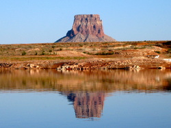
After a breakfast of oatmeal, Dangling Rope Marina was on the agenda for ice, water, and pump-out. But leaving the anchorage became complicated when a fresh breeze came from the south, on the tug’s stern, causing the stern-tie line to tighten and the anchor line to go slack; something we had not experienced before. If the stern-tie was let go, the tug would pivot into the rocks on the shore. The anchor could not be winched in while the stern-tie was tight. Laurie arrived at the solution: gradually pay-out the stern-tie line while bringing up the rode, easing the tug down the shore line until the rocks were passed and then release the stern-tie line and let the tug pivot in a tight arc and then bring up the anchor easily; and that is exactly what we did.
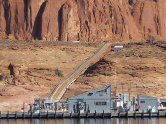
Dangling Rope Marina is halfway between the dam at Page, Arizona and Bullfrog Marina. It is floating in Dangling Rope Canyon, 80 feet above the bottom, and connected to the northern shore by a steep ramp where typically only the employees of the concession and the park service go. Hidden from view is the housing for 32 employees, a huge array of solar panels and a sewer treatment lagoon. The marina has many slips for day use only, a well-stocked store, a small information center, barges for garbage, recycling and fuel, a marina store and marina repair shop, four pump-out slips and a huge fueling operation for gas-powered craft; no diesel. Between Memorial Day and Labor Day, the marina is pumping over 21,000 gallons of fuel per day and the place is buzzing with jet skis, water skiers, go-fast fishing boats and an armada of slow moving houseboats. Today, we say four boats come and go; we would have it no other way.
The water was topped off and the tank probably took 10 gallons. The pump-out operation was problematic because the suction was so poor. Trying different stations did not change the result of the holding tank not being pumped out. The holding tank was only half full so there was no crisis. A couple in an AWB (an average white boat) was very interested in the tug and asked all the usual questions. They had the look of having the resources to get one. Another team of boaters chatted about the tug and was envious of the fuel economy; the tug had gone about 140 miles on about 25 gallons.
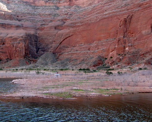
Continuing down-lake, the tug was powered up to 12 MPH, passed a houseboat and five miles later, turned into Dry Rock Creek Canyon. The land had stretched out, leaving behind the sheer, high walls. This half of the lake had long stretches of open land that was punctuated by tall palisades, buttes and bluffs. Dry Rock Creek Canyon was open, with buttes and benches that were etched with arches. Travelling the straight length at 12 MPH was perfectly appropriate. Like all the canyons, the trip out is completely different from the trip in with different views, features and lighting and never seeing the same thing twice.
The lake’s straight direction was interrupted by Camel Rock and Gregory Butte that rose up and extended from the southern shore; it made you take notice and go nearly completely around it. Experiencing Lake Powell at 8 MPH is like seeing a slide show in a museum while strolling through it. The detail is experienced with opportunities to talk about them. The imagination has the chance to discover and to create and the whole experience is relaxing with a cold drink in hand and lunch is easily consumed. Seeing the lake at 25 MPH would be like seeing a movie with action scenes causing the response of readiness and anticipation of what would happen next. It would grab the attention as the story unfolds. Both are different ways of enjoying the lake, with something for everyone.
As the land continued to stretch out with less and less elevation, there was some hesitation in discerning the right course to take. The higher water had created passes where some go-fast boats were using and being able to see at least 50 miles on this clear day created some depth perception issues. But the chart plotter told the truth and we followed its information, turning at Padre Butte in Padre Bay and turning to starboard into Gunsight Canyon at mile 16 or 16 miles from Glen Canyon Dam.
Gunsight Canyon is long and wide and we sped down its length under the great expanse of blue sky with temperatures in the low 90’s. At the head of the bay, we turned to starboard looking for a suitable place to anchor when we saw a small houseboat, clearly not a rental, with a person waving widely at us. We picked through the shallows until yelling distance was achieved and they told they needed help. Did we have any 20 amp fuses, they asked. They had blown their fuses while doing repair work and these were needed to start their motors. We had a whole array of fuses and always carry 20 amp ones. It was too tight to anchor where they were so we idled out into the open, dropped the anchor and Laurie stayed with the tug while I took my electrical bag in the dingy and delivered the fuses to Wayne and Gretel. They were very appreciative and thankful. They had called in their situation on the VHF radio when they saw the green tug, they thought were the park service at their rescue. Well, they were not far off, being former park rangers who would gladly help.
Anchorage was eventually found across the broad canyon and into a side canyon. The anchor was dropped in 11 feet of water and the stern-tie was run up the hillside about 150 feet. A gentle east breeze blew all afternoon as the temperature rose to the mid-90’s. A blue tarp was hung in the cockpit to create shade and all heat mitigation strategies were employed. More boats and more airplanes were seen and heard; clearly we were closer to civilization. During dinner, the Wallas stove overheated, a first, which was attributed to the 125 degrees of solar heating on the exhaust event and the 90-degree air temperature inside.
The twilight brought a clear and still air with the fish feeding.
Tuesday, May 15
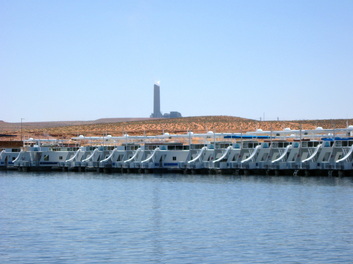
Rental houseboats lined up by the coal-fired generating facility
Totally still air and mirror-flat water. The inside of the cockpit canvas and the boat’s exterior had a billion little gnat bodies. A few hundred had gotten inside and were easily brushed off the windows. The tug was underway at 9:30 AM and the destination was Wahweap Marina that is at the western end of the lake and close to Glen Canyon Dam. The goal was to get to the end of the lake, get some diesel and pump-out. We found out soon enough, that was not going to be quick or easy.
The 14-mile trip took about 90 minutes because we cruised much of the distance at 12 MPH. The elevation was becoming flatter and the desert features were less interesting than those up lake. The water level was high enough that passage to Wahweap was possible around the north end of Antelope Island and this saved a few miles. Wahweap is the urban hub of Lake Powell, being close to Page, Arizona and the major highway that crosses the dam, and sharing a boundary with the Navajo Indian Reservation. Plus, there is an active general aviation airport.
From a distance, the huge smoke stakes of the coal-fired generating plant, the massive power transmission lines leaving the dam, and the string of marinas with hundreds of houseboats fill the scenery. The full spectrum of houseboats were seen, from the older one-family model that was probably passed on to the next generation, to the ultra-modern, 100 foot long, three story high model that probably required a hired crew to run.
The first stop was the NPS pump-out station near the main boat ramp but it was closed due to being struck by a tour boat. My guess was that they had new employees aboard and made a mistake. We idled north to the NPS pump-out station at the Stateline boat ramp and found a large yellow sign, “Winterized for the Season-use the main ramp pump-out.” Laurie found a helpful park service maintenance worker in the pump house who looked at the sign in disbelief and said this facility was open. We tried to pump out using the cobbled together fittings that worked in Bullfrog but to no avail. The worker loaned us a fitting but it was the wrong size.
The pump-out fitting was a surprise though I had thought about it. In Puget Sound, all the pump-out stations have a tampered rubber fitting that can fit a number of deck fittings, so we never purchased one. Here, having the proper fitting is the boat owner’s responsibility. So, now the Laurie Ann has the right pump-out fitting. What should have been 20 minutes of errands took two hours. Pushed a little farther in this heat with bad information, I would have solved the pump out problem with a turn of a valve, a push of a toggle switch, and about three minutes in very deep water at 12 MPH.
Heading for Glen Canyon Dam with 20 more gallons of fuel just for a margin of safety and a holding tank that was still 2/3 full, the course was set for the dam. I could not come all this way and not see it. The over 500 foot high structure was built at a very narrow place and because the water level was nearly full, 3,700 feet above sea level, the size of the dam was hidden by the lake. But the huge arched vehicle bridge and the mammoth power transmission lines were impressive. We took photos of these with people taking photos of us. Then, we turned at mile buoy 0 and headed up lake, following the old path of the Colorado River and taking the southern route around Antelope Island and avoiding the bad memories of Wahweap.
The southern shore of the lake is Navajo Indian Reservation. The tug took us along at 12 MPH past the Antelope Boat Ramp and then at no-wake speed past the new sprawling houseboat moorage and rental at Antelope Marina. With the forecast of 25-knot winds from the southeast and the southwest and gusting higher, the search was on for a suitable anchorage.
While evaluating a small cove at West Canyon, mile 28, the ever reliable Yanmar engine had a hick-up, it would idle but nothing more. Though it seemed longer, it probably would not accelerate for 20 seconds and then it came to life and operated normally. Continuing the search, but wondering if there was an underlying issue, the anchor as dropped in a cove in Dungeon Canyon that was cut into Cummings Mesa. Extra line was set out with the bow facing southeast and the stern-tie was firmly affixed to small boulder. Through the evening blasts of wind from the southeast and the southwest would stretch out the anchor line and tighten up the stern-tie line but the Laurie Ann stayed fast in about 12 feet of water.
With close to 60 miles and a long day behind us, the first order business was a cool down shower in the cockpit, followed by drinks for the crew and a dinner of fajitas. A phone conversation with Norman Gregory about the Yanmar was comforting with his guess being contaminants in the ejectors and the fix being to run them out.
At about 9:30 PM, the temperature had cooled to 85 degrees and the unpredictable Mother Nature threw some huge windblasts from the north, which ran down the faces of the nearby bluffs and pushed the tug away from shore causing the stern-tie line to be the anchor line. Then, the breeze dropped away leaving a heavy stillness of 90-degree heat.
Wednesday, May 16
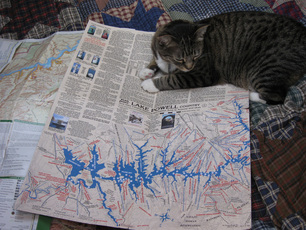
Boots and the Stan Jones map
Not the best of sleep due to heat and concern over the engine and like most worries, it was all for not. A simple test of running the engine out of gear found it to be like a well oil sewing machine, purring and smooth acceleration through all RPM’s. A read of the engine manual, was the re-discovery that the engine should be exercised in neutral from idle to full speed.
Down the cove from us was a houseboat with the banner “Trash Tracker” and as they pulled away and went by us, we learned from the decals that they are park volunteers whose mission is to pick up after us and keep the park clean. Doing their work is a calling and hopefully the expenses of the rental houseboat, fuel and other needs are taken care of.
The highest priority was the pump-out so the destination was Dangling Rope Marina about 5 miles away. Though the marina is located in Utah, they are serviced and supported by the Wahweap Marina and its staff in Arizona where daylight savings time is not observed. Therefore, the Dangling Rope Marina’s clock is an hour behind everyone else. As the marina was approached, the warning signs received greater notice. The park service makes the wording of their signs an art form. Rarely do their signs use the work “NO.” So, instead of the commonly used sign of “No Wake Zone.” Their sign reads, “Slow Wakeless Speed.” Maybe only the law enforcement rangers have the authority to use “No.”
We arrived at the floating marina at about 9:00 AM and the employees were just opening up. We did not need them for the pump-out is all self-service. Now, with the right fitting, the job was done easily and quickly. Another boater stopped to ask about the tug. All tug owners know that these conversations go with the territory of owning a Ranger Tug.
Heading back up lake the tug jump up to 13.5 MPH, apparently responding to having 250 pounds of waste gone. The wind was building behind us and pushed us across the rippled lake where, in the longer fetches, the waves were building higher. The wind followed the canyon walls so as we turned, the wind turned. Our next destination was Reflection Canyon and its spur, Cottonwood Gulch about 12 miles away. The entrances to the canyons and sometimes the route inside the canyon can be difficult to find because the color and shapes can be very similar. The chart plotter was the essential tool to take the guesswork out and using the vector feature that puts out a line on the course being taken, makes the traveling more efficient.
Reflection Canyon was a recommendation by a boater at one of the marinas and it was taken to its head, going around standing pillars of smooth rock and the triple digit depth went nearly to the canyon walls. At the end, an AWB was beached and a campsite was set up. Leaving the two canyons after 45 minutes of exploring, the journey up lake continued. The wind had subsided and the water was smoother.
Cottonwood Canyon (not the gulch) was chosen for a lunch stop. Pulling in at 12:30 PM we dropped anchor in 20 feet in the middle of the canyon, not far where the tug was secured for its previous overnight stay. A nearby houseboat with three tents and an awning was quiet and the place compelled us to just stay. With the afternoon winds building as predicted, more rode was let out and a stern-tie was put ashore. A tie, which over the course of 7 hours would be moved twice as the wind intensified and shifted directions. I did billable hours and Laurie read; both of us satisfied and enjoying the time. In the late afternoon, a boat full of adults arrived at the houseboat, the loud voices carried across the water over dinner and when the generator started at 9 PM, our desert wilderness experience ended until it was turned off at 10 PM.
Thursday, May 17
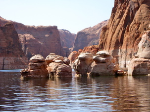
A delightful morning at Cottonwood Cove with clear skies and mirror-like water. We idled out of the canyon at 9:00 AM and followed a houseboat and their pontoon boat out to the lake. In no particular hurry to cover the 30 miles to Bullfrog and pullout the tug, the first destination was Ribbon Canyon where the forks were explored and more houseboats were found camping. It seems the runabout or fishing boat does the scouting for the houseboat and they pick a sandy beach to nose their large flat and metal bow into the sand. Then, lines are angled out from the stern to anything sturdy or, if finding none, large stakes are hammered into the beach. Beach chairs and awnings go up, tents for the guests that you do not want close to the houseboat, the generator is placed as far away as possible and then all the fun craft, personal watercrafts, fishing boats, ski or wake boarding boats tie up to the houseboat as it functions as floating dock. Pirate flags must be standard issue wit the houseboats and the vast majority were flying them.
Ribbon Canyon has some of the tallest walls we had experienced, causing the GPS to repeatedly lose its connection with the satellites. Then came Ice Berg Canyon probably aptly named for the large boulders that rise above the water’s surface like stone icebergs. Again, more houseboats, more skiers and more people. Every day that was closer to Memorial Day and every mile that was closer to one of the marinas, the density of boaters was noticeable. Slick Rock Canyon was last canyon entered on this trip and it was a short tour because of the boats and their wakes. More people, more wind with the weather turning; It was time to leave the lake.
The Laurie Ann had been in steady forward motion, without a break, for 6 hours as we approached the pump-out station at Bullfrog. The wind was a steady 20 knots with whitecaps when the tug’s throttle would not respond when it was put into gear from neutral. But reverse idle work fine, so the tug was backed into the pump-out dock and secured. A helpful resort employee who was participating in a repair of the dock, offered to get us a tow to the boat ramp. We accepted and an hour later, a small boat arrived and took as to the boat ramp. The tug had sufficient power using idle speed and it’s thrusters to make the landing in very breezy conditions. Within 30 minutes, the Laurie Ann was on its trailer in a large parking lot being ready for the road trip.
With the dingy in the back of the truck, we paid for a night stay in the tent campground because we did not need power or water. The campground at Bullfrog was designed for boats on trailers with extra long parking at the campsites.
The afternoon heat climbed to nearly 100-degrees as we sat in the shade of the hull and toasted the trip and our good fortune with a beer. In the twilight the wind climbed to 40 knots and the lake's surface was all foam. As the tug rocked gently on its trailer, sometimes my brain would want to check the anchor and stern-tie. That's right, we are on land.
Last Chapter
There are repairs to be made and items to be replaced. In 9 days on Lake Powell, the Laurie Ann went 316 miles, the engine operated for 45 hours, used about 100 gallons of fuel, and we used about 50 gallons of water.
We arrived home in three days spending one night at a KOA and another night at the Wildhorse Casino in Pendleton, Oregon after the KOA there refused to allow us in saying camping in boats is prohibited. Staying at a Indian Casino was a first for us and is recommended: ample parking, you are welcomed, great food, and its free.
The engine problem was due to a partially clog fuel filter that was likely the result of getting bad fuel in Wahweap. The fix was new filters and about two hours of labor.
The boat's hull had a mineral type of stain that was initially hard to remove. However, using a spray bottle with a mix of vinegar, isopropyl alcohol and water and then scrubbing with Dawn soap, stripped it all off, and the wax too. That and two hours of waxing, the Laurie Ann's hull is gleaming again.
