- Home
- Lake Powell, Utah
- Broughton Islands
- Barkley Sound, Vancouver Island
- Blog: Barkley Sound, Vancouver Island
- Desolation Sound
- Blog: Desolation Sound, British Columbia
- Princess Louisa & Gulf Islands, British Columbia
- Blog: Princess Louisa & Gulf Islands, British Columbia
- Great Loop Part 1, Chicago to Mobile Bay
- Blog: The Great Loop, Part 1, 1600 miles of River Boating. Updated 11-6-10
- Getting Boarded & Inspected
- Boating With Boots, the cat
- Checklist & Instructions
- Living in the World of 12 Volts
- Making Use of Smaller Spaces
- Ah, the Head & Shower
- Trailering and Camping with the Tug
- Tools & Cleaning Materials
- Trailering & Insurance: When bad things happen
- The Last Chapter
- About Us
- Contact Us
The Broughton Islands in a Ranger 25
If you go and what we learned along the way
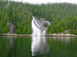
The Broughton's is a great place. Calm and smooth cruising waters, wonderful people and beautiful scenery. It is isolated with no garbage service, no pump out facilities, limited fresh water, a few places for fuel, no AM or FM radio, a few places have Wi-Fi, and spotty cell service. The wildlife is good but not great. A century of taking resources reveals spotty fishing and crabbing, few birds, and few large mammals. This is not Alaska but it is not Seattle either. It is far less crowded than Desolation Sound in July. Port McNeill is the normal jumping off place and is perfect for the trailerable boat.
Have a good chip for your chartplotter that provides the finest detail. You must have the Canadian paper charts, and there are three for this area that can be obtained in Port McNeill or elsewhere. The guidebooks we used were: "Waggoner Cruising Guide," "North of Desolation Sound," and "Best Anchorages of the Inside Passage." Each has its strengths but all three taken together, provides a comprehensive information. A tip: take the books to Staples and have them remove the original binding and replace it with spiral bound for about $5 each because the books will lay flat on the table with the desired page open.
Our statistics for this trip: 13 days, 311 miles, 50 gallons of water, 75 gallons of fuel, 2 sacks of garbage, one food provisioning stop, and a zillion smiles
Monday, July 11: The Beginning
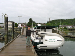
The Broughton's is a mass of large and small islands near the top of BC's Vancouver Island, north and west of Desolation Sound and that are typically accessed by large boats making the long passage up the Strait of Georgia. It is the last group of islands before the Queen Charlotte Strait and the gateway to Queen Charlotte Sound, Prince Rupert and eventually Southeast Alaska. Some boats, take a week or more to get here. Today, we did it in day.
Our journey started with a frenzy of preparation to the boat and the trailer. We only do these projects when a deadline is approaching, so interior wood was refinished, the VHF antenna was fixed, and a bilge pump hose replaced. Old things thrown out, new things stored. Three days before the leave-date, a look on the inside of the trailer's wheels revealed gooey grease on the hub and disc brakes-a sign a grease seal had failed and a foretelling that the bearing would surely fail also; maybe in 5 miles or in 500 miles. When the local Les Schwab Tire & Brake shop said they could fix it on Saturday, then changed their mind after looking at it and said they do not work on boat trailers with hydraulic brakes, my friend and I did the whole job in 90 minutes in his driveway.
We left today, Monday, July 11 at 0700 from our home in Marysville, WA, crossed the border at Blaine where the Canadian custom official was more interested in the type and features of the tug than us. Customs officials on land treat us like tourists; customs officials on the water treat us like smugglers with interrogations about alcohol, fruit and vegetables. We boarded the 10:15 ferry at the Tsawassen Ferry Terminal south of Vancouver. Lots of conversations in the ferry line as RV'ers and other boaters marveled at the tug on its trailer.
Inside the ferry, the deck hand who was directing us, succeeded in jamming the trailer's tires against a guardrail. The truck was stuck and the trailer tire's sidewall was folded and looking like it would soon fail. With the deck hand looking down and walking away, the tire strain was relieved by forcing the trailer backward and closing the gap between the dingy on the swimstep and the truck behind us. During the two-hour ride to Nanaimo, I had the opportunity to cool my frustration and come up with a solution: grease. I greased the guardrail and the tire wall. Then, when it was our turn to pull forward, the truck's four-wheel low gear easily pulled the trailer tires off the guardrail with no damage to the tire.
Then, northward for over 200 miles on Highway 19, through Nanaimo’s stretch of a dozen signals on a freeway, fuel in Parksville, lunch near Campbell River where the divided four lane highway went to a two lane one, and over and through the mountain range that blocks the Pacific Ocean rains from BC's sunshine coast. The road is an easy drive with a steady 50 MPH pace. We arrived in Port McNeill at 6:15 PM, paid our launch fee and a 14-day parking fee for $35 and pulled away from the good concrete ramp with a finger pier at 7:15 PM. We stayed the night at the Port McNeill Marina, a private operation, next to a 197 foot sailboat that rumor had was chartered out for $330,000 a week. We had a nice dinner and slept soundly.
Tuesday, July 12: Behind Crease Island
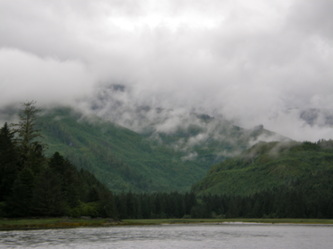
High, bright clouds filled the morning sky but the climate was dynamic as the clouds fell to the water’s surface, encasing everything in a fog. Then, it would lift to about 100 feet, obscuring all the mountains in the background. As the temperature rose, the clouds fully lifted to reveal the majesty of the snow-covered peaks, 30 miles away. After breakfast, we paid our slip fee and took a walk around Port McNeill admiring the remodeled houses on the shoreline. At the Shop-Rite Marine and Logging Store, we bought Canadian charts for the area and crab bait. Then, at the local sporting goods store, we found the owner to be a wise fisherman who outfitted Laurie with a pole and rig so she could catch her own crab bait.
We pulled away from the dock at noon after a light lunch and headed east on the flooding current, going with God, as the tug was powered up to 13 miles per hour. We paralleled Malcolm Island and stayed north of Cormorant Island where the BC Ferry stops at Alert Bay, jockeyed through the current swirls and rips at Stubb Island and made the short crossing of Blackfish Sound to officially enter the Broughton Archipelago at Swanson Island. Past Swanson Island, we turned southwest into Swanson Passage, out of the breeze into completely flat water, and proceeded around the south side of Crease Island to eventually turn into the anchorage behind Goat Island.
We joined 6 other boats that were scattered about the small anchorage, dropping the Danforth in 20 feet of water and setting it in the gooey mud. We dropped the crab pot after hearing that crabbing was fabulous in the Broughton’s. Though we dropped the dingy, we ended up spending the whole afternoon on the tug as we were visited by Dennis and Sue who were from the nearby 50 foot Ocean Alexander. We talked about Ranger Tugs, their Grand Banks 36, boating on the Columbia River and both of us being owners of Escape Trailers.
During our conversation, the seat of one our folding chairs split the stitching, so after they left, we found needle and thread and made a repair.
Later, an ageless old fisherman without any teeth came from a nearby ageless old commercial fishing boat to tell stories of growing up in these islands and the days of prosperous fishing. He spoke of the weird weather, how crabbing was terrible, and how drugs had come to the small communities. Shamefully, we did not want to be too nice to him because he probably would have stayed through dinner. We grilled chicken strips and stir-fried vegetables followed by brownies and hot chocolate, The fresh breeze dropped flat during the 10 PM twilight and the full moon rose from the Southeast. Quiet and still, calm and peaceful.
Wednesday, July 13: The Beginning of Knight Inlet
In the morning light, the difference between sea and sky is subtle and sometimes indistinguishable in the shades of gray. A few boats were leaving in the fading ebb tide, probably heading west to Port McNeill and points toward the horizon. We left after the predicted slack tide at 9 AM and caught the slowly building flooding current past Maud and Pearl Islands to Village Island, and thinking about exploring the abandoned First Nations village and mission site.
The story was a government crackdown on Potlatch ceremonies, seizing property, criminal charges and the unspoken tale of disease and the catastrophic loss of life and the evaporation of a culture. From the water, the island had a forbidding nature about it with piers gone, leaving only rotting pilings, a smattering of hollow buildings and dense forest that seemed like a wall to keep out intruders. We circled about small bay, headed south dodging rocks and islets to Native Anchorage and then down Canoe Passage were it narrowed and blocked our passage.
Honoring a feeling to leave this place, we retraced our wake and left the Indian Group of islands to enter Knight Inlet, riding the 4-knot flooding current eastward. Current swirls and mild rips were felt and slowed us at Tribune Point as we crossed over to Gilford Point on Gilford Island and through the deep passage that is guarded by Lord and Lady Islands to enter Port Elizabeth. Cruising at 8 knots and sipping diesel at a gallon per hour, we were explorers of new places. A look-see at the aqua-farming operation and Maple Cove, we turned around, powered up to 13 knots and headed east keeping the Georgina Range Mountains on Gilford Island close on our port side.
Near Stormy Bluff on Gilford Island, a pair of Pacific White-Sided Dolphins rode our bow and stern wake, jumping, swimming and turning before turning away. A few hundred yards later, another pair joined us before veering off. By the time we reached Shewell Island and Clapp Pass, two miles later, four pairs of dolphins had played with the tug.
We turned to port at Sargeaunt Passage and slowed when it narrowed and shoaled and thought about lunch behind a sand bar and perhaps anchoring for the night between the high and steep slopes on each side, but we were not “feeling it” as it felt like parking on a side street; not much privacy. So, we turned around, crossed Knight Inlet and went around Protection Point and into Tsakonu Cove.
The cove is triple digits at its entrance and shallows quickly at the head where an old and abandoned logging operation was found. In the drizzle, we dropped the anchor in 20 feet of water knowing that 12 feet would disappear at the low tide. The drizzle built to a full downpour, droplets causing bubbles in the water, a drumming on the tug’s hardtop and drips coming through worn spots on the canvas and the occasional screw. We enjoyed showers, reading, and playing cards as the iPod entertained us. We were glad for the diesel heater, the hardtop and the flat and smooth ride with no wind. But we felt a feeling of anxiety, of withdrawal with no phone service, no Internet, and no radio.
With the light breeze changing direction to come down the inlet, the tug’s anchor scope allowed us to drift into too shallow of water. When the rain eased, or the shore got too close, or it got too shallow, we would need to move and re-set the anchor. We did so and fell asleep to the water gently lapping the bow as the fresh breeze blew down the cove.
Thursday, July 14: Bears on the Beach & Lagoon Cove
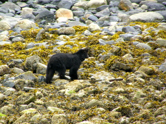
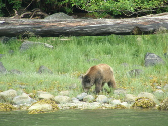
Clouds, drizzle and lifting fog began the morning as we awoke to lowtide and the steep bank of rocks was 40 yards from the tug’s transom. Laurie said this was perfect morning for a bear to be on the beach and she was right, a young black bear was foraging on the beach about 100 yards away and it stayed with us until we left the cove, fixated on finding a meal under the rocks. After oatmeal, we powered up the tug and headed east up Knight Inlet toward Glendale Cove where Knight Inlet made a 90-degree bend to the north and where grizzly bears were commonly seen. The water was flat and the wind was still, so we kept the tug powered up to its fast cruising speed of 12 to 13, slipped past Prominent Point and Rest Isles. We were completely alone until two sightseeing boats passed us and we followed into Glendale Cove.
The east side of the cove was tourist lodge with buildings and cabins all floating on barges and docks. The small wharf was secured a floatplane and two small sightseeing boats. Across the cove was a short float that was exclusively used by the grizzly tours sightseeing company. As we explored the cove, three open boats loaded with tourists who were decked out in bright orange PFD jackets were along the shoreline line. They were watching a deer; no bear was in sight. The cove shoaled very rapidly from 60 feet to 15 feet. We dropped the anchor on the toe of this wall and waited.
After 45 minutes of enjoying the scenery of high mountains stopping steeply into the inlet, we pulled the anchor and started to ease out of the cove when Laurie saw the mother grizzly and her two cubs come out of the tree line and down to the water’s edge. Like the black bear during breakfast, these bears took no notice of the human observers as they foraged along the rocks. We idled along in 20 feet of water, only 100 yards away, taking photos and taking the event in. We had never seen grizzly bears in the wild. Laurie said, “This completes me.”
Finally satisfied, we headed out at 1230 and went with the currents down Knight Inlet all the way to Chatham Passage where we turned to port at Minstrel Island, eased past the old marina and the public docks. We idled through Blowhole passage and found a line of big cruisers forming up to dock at Lagoon Cove Marina.
This small marina holds about 24 boats but they sell fuel and have a daily happy hour where they provide the prawns if you bring a potluck side dish. Suddenly, we went from being alone to being with a talkative group of friendly boaters. We took 56 gallons of diesel, calculating that we used 2.6 gallons per hour and 3.3 miles to the gallon. Not bad, considering that the majority of the use was at the fast cruising speed of 12 to 13.
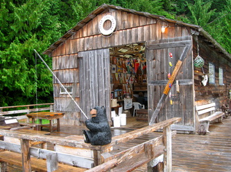
The marina was full with mostly Canadian boaters but there were a few Americans from Puget Sound in their 50-foot boats. We were the smallest boat and enjoyed mooring up to the end of the “Crab Shack” where boaters are provided propane and a big pot to cook their crab. The “Crab Shack” became an extension of our cockpit, as the rain was steady.
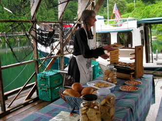
Jen brings were floating bakery to the marina every Tuesday, Thursday and Saturday and she arrived just after us, using the Crab Shack as her store. From her dingy, she brought plates of cookies, strawberry-rhubarb pies, sticky buns and fresh bread. Friendly and open, she is also the postmaster on the island who lives with her dog around the corner from the old Minstrel Island marina.
In the office, Pat gave us an orientation to the Lagoon Cove Marina; run a tab and nearly every expense is on the honor system, from showers to clothing. Water comes from their well, power is supplied by the generator that is heard in the distance, but there is no garbage service. Internet service is by their satellite and only for email or light browsing. Bill owns the marina and pumps the fuel and lands the boats. He and Jean have owned the marina for 19 years, building it as place that they would like to visit. A place of hand-made signs and a feeling of fun and light-hearted friendliness. Every day at 5 PM, he provides freshly caught prawns to anyone who brings a dish to share.
We enjoyed the potluck and the conversation with Bill. Laurie put together her fishing pole and took instruction from a 12 year old who was catching bottom fish. In 30 minutes, she had caught two shiner perch that succumbed during the intense battle. Laurie and boots went to bed early as the sun was going down at 9:30 PM. I stayed up and created several billable hours.
Friday, July 15: Holed up at Lagoon Cove
This was a banana slug day with rain, drizzle and showers all day. After breakfast, all the tools were thoroughly cleaned which also helps remember what tools are packed. Cabin fever set in by mid-afternoon so we geared up and watched from the docks as the majority of boats left for the next anchorage. A go-fast Coast Guard boat with a three-person crew arrived for fuel. They go so fast that they wear helmets with face shields instead of hats or being under a hard top. Talking freely, their mission is search and rescue from their base in Telegraph Harbor. The leader is full-time Coast Guard and the other two are college students who work two weeks on with two weeks off during the summer months.
At noon, we walked the trails to Blowhole Pass, up the hillside to Lookout and the Deer Loop Trail. In an hour we had blown out the cabin fever with blood pumping exercise in the rain, slogging through the thick rainforest where water-laden ferns would dump their water on pants, shoes and coats when they were touched. Nylon rain chaps that slip over our pants would have been nice. We slipped, pulled ourselves up a slope with a rope and tried not to think about bears. But the views were nice, the air was crisp and the forest was quiet and delightful. Back at the boat, showers for everyone and the head became a big clothes dryer with the help of the electric space heater.
Jean, the marina’s co-owner, invited Laurie to join a group of women to play Mexican Train at her house. The afternoon drizzle came and went. Boats left and their spaces were filled within the hour by newcomers. Everyday brought a new complexion of boaters to the marina. Today, there were more sailboats and more teenagers; the group’s mood was friendly. 20 people attended the potluck-prawn feed and we enjoyed the company. Afterwards, we spent time on the dock with Kevin and Jan and talked about their 40-foot Caliber sailboat, evading government fees, and the adventure of sailing up the west coast from San Diego.
Soup and fresh bread at 8:00 PM was followed by a movie for me and reading for Laurie.
Saturday, July 16: Tribune Channel & Kwatsi Cove & Marina
The morning sky was full of promise of warmth and sun. After breakfast, we waited for the tide to rise and the strong currents to ease. Some boats left but we were in no hurry to fight the ebbing tide. We cleaned, put away gear and paid our tab with Pat. She and Bob are the full-time caretakers and they talked of their lives on this northern tip of East Cracroft Island, living on the boat near hermit Bob who is 80 years old and intends to die here. They have lived on a boat for 30 years. He worked most summers and she worked a variety of full-time jobs before coming to Lagoon Cove 4 years ago. Now that the marina is up for sale, their future is uncertain but that does not seem to weigh heavily on them.
Their living routine is simple; once a year shopping in Port McNeill for the basics and food staples, shop every 6 weeks for fresh food with Bob running their small boat to Port McNeill when the weather is settled or having a neighbor bring the supplies to them. Bill and Jean leave for Arizona in the late Fall, come back in January for taxes and return to live in late April. Bob and Pat keep the fuel operation open every day; wintertime is mostly commercial fishing boats.
At 10:20 AM the tug was pushed away from the dock and we headed north toward Turnour Island and through Clio Channel into Knight Inlet. We powered up to 12 MPH to fight the last of the fading ebb, glided past Doctor Islets and through Clapp Pass into Tribune Channel. We were circumnavigating Gilford Island. Once past Bamber Point on Viscount Island, the speed was dropped to 8 MPH because the tug had caught the change of the current and was now riding the building flood tide.
The study of currents is an art form. The government’s current stations that document and predict current is only in the areas of the commercial boats. In these islands, boating is mostly recreational. Therefore, when and where the current behaves is all speculation and the topic of dock-talk. For Gilford Island, local knowledge said that the flooding tide flows around both the north and south ends and meet somewhere in the middle or around the area of Bond Sound. This is important stuff because when the current is running 6 knots and your big slow sailboat will only go 7 knots, fighting the current and making on 1 knot can make for a very long day.
Continuing northward and up Tribune Channel, we saw only the occasional boat. There was no phone service, no Internet, no AM or FM radio reception and no shore facilities. The only sign of human activity was the logged off areas and nearly all of those were re-seeded. At Cleave Point that is on the mainland, we were greeted by Pacific White-Sided Dolphins that jumped out of the water, swam along side and then raced away. River otters on a floating log and countless bald eagles entertained us along the way.
We looked up Thompson Sound and Bond Sound but continued on to make a starboard turn into Kwatsi Bay. This bay is about 2 miles long with triple digit depths in the middle. A small marina on the west end of the bay’s head can handle 12 boats. We opted to try to anchor in the east end of the bay with five other boats. Following the guidebook’s directions, we found the small undersea plateau that rises from 100 feet of depth to about 50 feet, dropped our Danforth anchor on it, and paid out 150 feet of scope. We dropped our crab trap on the plateau and hoped for the best.
The dingy took us to the marina where we met the owner and builder of the Kwatsi Bay Marina, Max; along with two of the boaters we had met in Lagoon Cove. There are boaters, like RV’ers, who only go from one established commercial facility to another because it is easy and has less risk and they leave the anchorage for us to enjoy. The dingy and its Honda 2 horsepower motor took us on a tour of the bay’s head, the small islets that protected the marina, the waterfalls that provided the steady drone of water cascading down the granite, and around the boats, who like us, were swinging on their anchors.
Sleep came easily and we did not hear the heavy downpour the punctuated the night.
Sunday, July 17: Around the Top of Gilford Island to Greenway Sound
My first clue of the magnitude of the night’s rainfall was the 5 gallons of rainwater the dingy was holding. Later, I would find the drips that came through the slightly opened windows that would stain the wood finish, another chore to do when the tug is in the driveway.
It was a morning for oatmeal with low clouds, light drizzle and cool temperatures. At the height of the ebb tide, we pulled the anchor, pulled the crab trap and released the trap’s only occupant, a huge sunflower sea star, raised the dingy and idled out toward Tribune Channel. Riding the ebb current added 2 mph onto our speed. Just past Watson Cove, we headed toward the north shore for a closer look of Lacey Falls that spiraled down the steep slope and then spread out in a fan as it entered Tribune Channel.
Continuing westward through mild tidal rips caused by the approaching slack current, we powered up to 12.5 and skidded down the channel until we came upon a massive debris field of logs, sticks and kelp at Smith Rock on Gilford Island. Idling around the obstacles, we continued on to the Burdwood Group of small islands and islets that is between Gilford Island and Broughton Island. All of the islands in this small group had numbers, not names. We thought about snaking through the islands, evading rocks and jutting points, but opted against it.
Looking east, we saw Scott Cove and the renowned Echo Bay Marina that is not in Echo Bay, with the mass of big boats moored there. Going on around the Burdwood Group, we went northwest up Raleigh Passage, catching a couple of oncoming boats headed to Echo Bay, and went between Hayle Point and Trivett Island to find our way into the back of Laura Bay.
There was anchorage behind an islet but found four boats shoehorned in there and stern-tied to the shore. Further back, where the bay necks down and discourages the big-boy boats from entering, we found a lunch spot in 24 feet of water and 30 feet from the tree line. We put out a 2 to 1 scope for this 30-minute holding and enjoyed a fine meal.
The day was still young and the promise of sunshine spurned us on to find a place to get off of our little boat and stretch our legs. The realization of getting off the boat to explore caused me to appreciate the San Juan Islands and the Gulf Islands more because nearly every one of those islands have opportunities for walking. Here, the rainforest of this region is impenetrable and intimidating. In the whole region of at least 400 square miles with countless islands, there are probably less than a dozen places mentioned in the guidebooks to walk and explore.
We continued heading northwest, through Penphrase Passage, past Gregory Island, around Stackhouse Island and briefly into Sutlej Channel before turning to port into Greenway Sound. This S-shaped inlet has a lagoon to explore at slack tide near the entrance. We looked at anchorage behind an islet near the entrance but opted to continue down the sound with the possibility of walking to Broughton Lake.
The Greenway Sound Marina did not open this year when the long-time owner sold it and the new ownership fell apart. As we approached the 2,000 linear feet of floating dock, the boarded up store, restaurant, office and diesel generator buildings, there were a few boats spread out on the long docks. We circled the docks and looked for signs of warning or controlling and seeing none, we idled up to two sailboats that were far enough a part to have privacy, and tied up. We quickly learned that this was all free but no services, which was fine with us.
Again, we were the anomaly: the smallest boat and who did not sail for three weeks to get here. These boats were nice and expensive and operated by people who had the whole summer off or did not work full-time anymore. But, like the weather, they were nice and enjoyable. After all, just getting to the Broughton’s qualifies you for a membership into something special and unique.
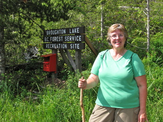
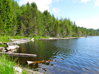
The dingy was tipped off the swimstep into the water and we headed for the dingy dock that was the beginning of the trail to Broughton Lake. The BC Forest Service crew had rebuilt the ramp, cut steps into the hillside, added walkways across the worst of the muddy trail and built a pit toilet. The trail was muddy, the rocks were slippery but the lake was worth the price of admission. We were back on the tug an hour later to rinse out the mud in our shoes and have dinner in the later afternoon. A warm afternoon without a cloud in the sky and tied to dock that Boots can explore, it does not get much better.
Monday, July 18: Jennis Bay and Allison, the gracious host
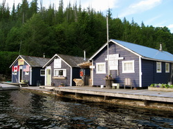
The typical summer weather pattern began to emerge of low clouds or fog at sunrise that would slowly lift with the rising temperature and the wind was still. By afternoon, the sky would clear and the warmth of the day said that summer was here. Sometimes the breeze would freshen and build as the day progressed. Morning was powerboat weather; afternoon was for sailboats.
We had a great dock conversation with a Canadian who keeps his Grand Banks at Campbell River. He told a wonderful story about his Welsh Springer Spaniel who repeatedly survived being cut by oysters and nearly bled to death, jumped or fell overboard in the Strait of Georgia and picked up by a tug boat many hours later and was still swimming strong 12 years later and being nearly blind. He also gave us a short list of his favorite places and made a compelling argument to go to Jennis Bay Marina where Allison runs a business with her two children, ages 12 and 10.
We came to understand that the Broughton Islands could be divided into thirds from north to south. The southern portion starts at Port McNeill and Johnstone Strait and goes to Knight Inlet. The middle portion is the central band that includes Gilford Island and the northern tier includes Echo Bay and Jennis Bay.
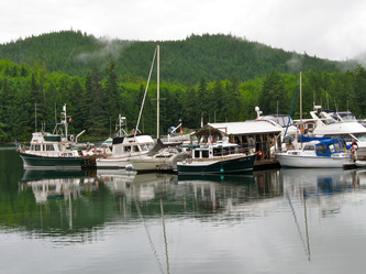
The marinas that are scattered about the three tiers are different in the services, size and sophistication. There is one that caters to high-end boats and deep pockets, while most have a unique character and a signature service or event. Lagoon Cove has a daily prawn feed & potluck, Echo Bay has a Pig Roast, Shawl Bay Marina has daily pancakes, and Jennis Bay has a Cajun Dinner and Potluck every Tuesday. These marinas are typically not big operations; they can often only take 2-dozen or fewer boats and if you are looking for fancy and modern, this is not the place. Small but quaint buildings often float on logs, not pontoons and thick rusty cables or chains, not driven pilings, hold everything in place. Electricity is by diesel generator. Water is sometimes available, there is no garbage service, and fuel stops must be planned for in advance. But, they are friendly, genuine and laid-back, nice people.
Armed with new information, we headed out of Greenway Sound and turned north into Sutlej Channel, circumnavigating North Broughton Island, with no wind and on flat water. We caught a glimpse of Sullivan Bay and its massive marina that is on the north end of the island as we went through Dunsany Passage that is the gap between Kinnaird Island and the mainland and entered Grappler Sound.
The guidebooks speak highly of the anchorage at Claydon Bay, so we poked in and idled around the perimeter of the bay that provides protection in nearly any wind. Then, we continued up Grappler Sound and went around the northern portion of Watson Island. At Watson Point, the channel necks down causing the ebbing current to kick us around a bit as we pushed through it. Then, 200 yards later, the channel was even narrower, but still deep and we avoided the small whirlpools caused the colliding currents.
We heard the roar and saw the mist rising from Roaringhole Rapids that was ahead. For 5 minutes at each tidal exchange, the water lies down enough to transit the rapids to enter Nepah Lagoon. Otherwise, the place lives up to its name. We idled up to a safe distance and took in the wonder of the power of nature’s engineering.
The tug turned around in its length and headed for nearby Turnbull Cove. This has a deep but narrow entrance but the cove is ideal for anchorage in any weather with a flat, mud bottom of a steady 37 feet. The cove is more recently known for a huge landside of dirt and trees that came down from the top of the 1,000-foot high ridge. The wide and open scar is a headline that the forest roots are quite shallow and given enough rain and the right conditions, things will slide. The writings of a boater who was present during the massive slide and survived stayed with me, “Of all the ways to be injured or killed on a boat, I never thought a landslide would be one of them.”
We dropped the Danforth for a lunch hook at the western edge of the cove. Four other boats were swinging on their anchors and this cove could easily take a 10 fold more. As we left, we looked into going on through Kenneth Passage but the number of rocks and the vague quality of the destination caused us to back track to Grappler Sound.
Unknown to us, the currents had intensified during our lunch stop. So as the tug neared Watson Point, we had to power up to 12 MPH to go 7 MPH. The swirls and whirlpools made for fun steering but nothing unsafe or uncomfortable. We stayed at our fast cruising speed through Grappler Sound and turning to starboard at Pandora Head that is at the entrance to Drury Inlet, the Stuart Narrows and eventually to Jennis Bay.
The currents were now with us and though the throttle stayed at a constant 3,100 RPM’s, the tug’s speed started to climb slowly and steadily and finally capped at 18.5 MPH as we entered Stuart Narrows. The charts and the guidebooks paint a clear picture: through the distance between the land is wide, the navigable portion is quite narrow, and this causes the water to run at a strong and steady current. We hugged the shore of an islet to avoid the submerged Welde Rock and though the tug’s engine was throttled back to 1,600 RPM, a normal speed of 6 MPH, the tug was doing 12 MPH.
What was more interesting than the current was the amount of logs and debris that had concentrated in the Stuart Narrows. This moving mass of gel-coat scratchers and hull punchers was avoided by anticipating where it as going and using the minimal maneuver speed to ease around it. At 12 MPH, the obstacles of Stuart Narrows were quickly behind us and soon Drury Inlet spread out wide with flat water and little or no current.
We sedately cruised along at 8 MPH until turning at Byron Point and entering Jennis Bay. Allison, the owner and operator of the Jennis Bay Marina promptly returned our radio call on channel 66 with a voice of welcome and hospitality. We went around the protective log boom and tied up at the end on a sturdy dock that could accommodate 10 Ranger Tugs. In this middle of the afternoon, there were four other boats. One, Wind Rose, we had met at Greenwood Sound, two were from Canada and Jerry & Gail were from Anderson Island; all are Jennis Bay Marina veterans.
It is easy to become a fan of Allison and her marina. She exudes a sense of confidence, competence and is a friendly soul who smiles a lot. But she is also struggling with being a single mother, a businesswoman, and all the challenges of keeping a facility safe and maintained in this beautiful but harsh place. After five years of trying to make it and enduring a recent divorce, this may be her last summer at Jennis Bay. Simply, you wanted to help and be part of her solution. Orion and Charlie are great kids and Bravo, the one-eyed, yellow lab mix greets everyone with the same attitude of love and appreciation.
Following the tradition of all the marinas in the Broughton Islands, happy hour begins at 5 PM and bring your finger food to share. We talked of crabbing and boating. No talk of occupations or jobs or schedules. Jerry and Gail are like Allison’s stepparents; they have come every year for weeks at a time. Gail and Allison have a level of trust and intimacy that is earned over time. For everyone present, Jennis Bay is as far north as they will take their boats. This is the turn around point.
We discovered the Internet to be reliable and phone service was possible with the cell phone amplifier. After a light dinner of grilled chicken on the BBQ and a dessert of tea and cookies, we spent the rest of the evening reading.
Tuesday, July 19: Cajun Night
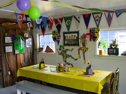
A Jennis Bay day. Under partly cloudy skies and after breakfast, we opted to stretch our legs on the logging roads that crisscrossed the landscape. Allison encouraged her dog, Bravo, to go with us so he could get some exercise but after 2 km, we came to a fork at a logging camp, Bravo wanted to go right to a cove and we wanted to go left. Bravo turned and lumbered back home. We had a great walk because we were able to stride out and to nearly do our 16 minute per mile pace. After 30 minutes, we turned and went back to the marina.
Tuesday is Cajun dinner day at the marina, Allison’s unique brand that brings boaters in. She had reservations from enough boats that the marina would be full but we could move to a 20-foot long float at the base of the ramp. It was deep enough, but close to the rocks and the tug would have to be backed in, a bit tricky but easily do-able with the thrusters.
After untying and idling out to the log boom, it was decided to put down the crab trap behind a small inlet near the harbor’s entrance. After dropping the trap in 40 feet of water and seeing a line of trawlers coming in, we continued into Drury Inlet and spent an hour doing a low cruise speed of the shoreline and islets. Laurie called her mom and I talked to a client using the cell phone amplifier; technology can be amazing.
We came back to a full marina and execute the docking maneuver easily and with an audience. While I worked on the computer, Laurie and a group of women started the preparations of the Cajun feast that Allison orchestrated. This was truly a community effort where the participants have no other connection other than being boaters in the same place and Allison is leading them. The uniqueness of this event was not lost on us; it was special.
In the course of a few hours, the group had prepared jambalaya, gumbo, and bread pudding for 30 people. Gail and Jerry, from Anderson Island near Olympia, made huckleberry pie on their Grand Banks. Allison brought out a box of decorations and the interior of the cookhouse was transformed into Mardi Gras. Everyone had beads to wear. At 6 PM everyone brought a dish and a beverage and the feast began. After dessert, Allison read two stories, like show and tell in school, which captivated and entertained the group, The Cajun’s Night Before Christmas and La Petite Rouge (little red riding hood-the Cajun version.)
After the dishes were gone and washed, Allison brought out the guitars and she and I played from the Jennis Bay Marina songbook while a smaller but enthusiastic group sang. Laurie and Allison sang harmony so sweetly that the blending voices were amazing. We stopped only because Allison had parental duties to attend to.
Wednesday, July 20: Shawl Bay Marina
Allison wanted everybody who was leaving to be paid up at 0900 hours and like all good soldiers, her office was overflowing with boaters buying their last mug and T-shirts. Slack at Stuart Narrows was at 1140 hours, so we were in no hurry to cast off our lines. Walking around the short docks, we learned that most boats were going to Shawl Bay Marina; another stop in the village of marinas whose brand was pancakes every morning and the “Bead Lady.”
While Laurie was socializing on the dock, I noticed that Sandy and her husband, guests on the 50-foot Fleming, were looking over our tug. We had a nice conversation that ended up with them learning about the Ranger Rendezvous in Bremerton and they may be coming to see the boats and meet the owners.
We said our good-byes to Allison, Jerry and Gail, and the rest of the boaters and idled out to our crab trap that had been soaking over night. We got one good keeper, killed and cleaned it and put in the refrigerator. Stuart Narrows was flat with a fading ebb current that took us through at 8.3 MPH. The low tide revealed Welde Rock and the source of the rapid-like water that was seen in the way in.
We moved up to fast cruising speed and went to Sullivan Bay, only about a 45-minute trip once the narrows was cleared. We followed “Wind Rose” into Sullivan Bay Marina and followed the harbormaster’s directions to tie up on the dock in front of the restaurant. Sullivan Bay Marina holds about 50 boats, has fuel, laundry, a restaurant, a general store and about a dozen homes; everything is on floats.
We walked the short distance to the general store where we spent $90 for food, a bottle of wine and a fresh berry turnover. The water tank was filled and though we used a large filter, the water came out of the faucet with a slight brownish haze, known as “cedar water.” Leaving Sullivan Bay Marina, our wake was re-traced past Greenway Sound and Stackhouse Island. The clouds were very low; rain was light to moderate with visibility about 2 miles. The chartplotter display was moved from a split screen of close in and far-out to chart and radar because I wanted to see any targets that the fog hid.
The rain and cool weather had us change our plans from anchoring behind Gregory Island to docking at Shawl Bay Marina. Unlike the big boats, we never make a reservation because we do not need to; nearly every marina can take a 25-foot boat at the last minute and they cannot, then it is not the marina for us. The Shawl Island Marina was no exception. They had a spot at the end of dock and we slid in behind a large Grand Banks and across from another one that was just like it.
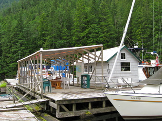
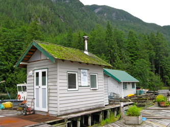
Loren and his dockhand took our lines, complimented the lines of the tug and off to secure a 27 foot sail boat that was coming in. The marina advertises that they have power but their power boxes did not extend to the end of our dock, so we did without. We walked the docks and noted that four boats from Jennis Bay were here. I followed the delicious smell of baking to find the bakery. The baker was spending the afternoon fulfilling an order of pies. We bought a couple of sticky buns and headed out. Shawl Bay Marina is a family owned operation for two generations. It can handle about 25 boats on its finger piers and like all the marinas found in the islands, the floating buildings are anchored between the land and the piers. Anchors, not pilings, secure the docks because of the depth. The Laurie Ann had 55 feet under her at the dock while only being a 200 feet from shore.
Laurie found the laundry shack and started a load, commenting that the water pressure was so low that the washing machine would need almost two hours to do a load. Then, the rains came; one cell after another and sometimes the intensity of the downpour caused you to stop what you were doing and take notice. We hunkered down and missed the 5 PM Happy Hour that is held under their big tent. We skipped the planned Jennis Bay crab for dinner and had pasta with Laurie’s homemade sauce instead.
In the early twilight, the rain eased and the marina was quiet. We finished the day by watching a movie on the laptop and using the tug’s sound system; small screen but big sound.
Thursday, July 21: Echo Bay, Billy Proctor and Waddington Bay
A cloudy and cool morning, with the ever-present threat of a rain shower greeted us. Breakfast was under the big tent on the floating dock near the office with all-you-can-eat pancakes but bring your own service. Garbage is a huge issue with no marina providing garbage service. Therefore, the world of disposable commodities has no place in the Broughton’s.
The pancake breakfast is another opportunity to visit and meet people. I had met Les at Lagoon Cove. He is single-handing his sailboat and though it is 11 years old, “I keep it pristine from the waterline on down because no one will steal a dirty boat,” it is still in good shape. Les has a significant, but unrevealed health problem, and this may be his last summer in the islands. He has come to the Broughton’s every year for over 10 years. Now, he moves from marina to marina, re-establishing old relationships and making new friends. That is part of the draw of coming to the village of marinas and being a part of the community of boaters who migrate to the islands each year.
Laurie met Ross and Ileana who keep their 44-foot sailboat in Blaine, Washington and live in Sun Valley, Idaho. Like Les, they have come to the islands every year and spend weeks at a time. They are talking of selling their sailboat and staying in Sun Valley year round. They came by the Laurie Ann to look her over and to mark our charts with their favorite places.
Loren and his wife, the owners of Shawl Harbor Marina were making the rounds of who was staying and who was leaving and planning their dock space accordingly. They run a deep fried turkey dinner on Friday nights and they anticipated another full marina for this event. Boats were leaving and within 30 minutes, half the marina was empty; we joined the exodus.
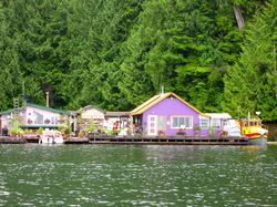
Laurie had met the “Bead Lady” at her shop at Shawl Harbor, received her traditional hug, and told Laurie where she lived on the water. It was unmistakable; purple house, red roof with old tug whose windows were trimmed in yellow. Laurie had to take a photo of it.
After rounding Vigis Point, we continued southeast down Penphrase Passage to the Burdwood Group of islands at Raleigh Passage. We came to understand that the Burdwood Group is like the round-a-bout for this region, with sounds and passages angling off from the center. Echo Bay was on our list to see, not for the marina, but for Bill Proctor’s museum. Laurie carried and brought three guidebooks for this trip and one of them briefly mentioned that there was a short dock in front of Bill Proctor’s Museum.
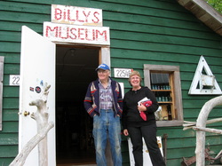
We found the dock, only about 30 feet long and as we idled up to it, Bill Proctor and his old yellow lab came ambling down the ramp. We tied up and Bill took us up to his museum. Bill Proctor is a legend in the islands. Pushing 80 years old, he grew up in these islands as a fisherman. For 70 years, he “collected stuff” that he found on the beach or that caught his attention. About 20 years ago, he was visiting a local museum and realized that he had “more stuff” than they had, so he built his museum near his house and has been greeting about 3,500 visitors a year.
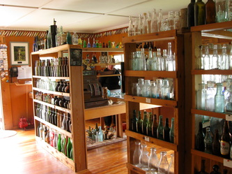
We spent over an hour in Bill’s museum that was neatly arranged with fishing gear, logging equipment, glass bottles from all over, photographs, newspapers and “other stuff.” Over time, he warmed up to our questions and talked about time when the fish runs were huge, how logging had help destroyed the fishing, how the government had over-protected the predators that has caused an imbalance in nature. Bill believed that the Pacific White Sided Dolphin that we had enjoyed was one of the main causes of the lack of fish. Now, fishing is almost non-existent, and crabbing and prawning are only a fraction of what it used to be. Bill and other locals used to operate a salmon hatchery but that failed.
Bill is a published author and his book, “Full Moon, Full Tide” has sold thousands and is its third printing. Billed as an environmental activist, Bill Proctor is critical of the government, the permitting of aqua-culture farming where Atlantic Salmon are raised in pens, and is worried about the future. In his gift shop, Laurie found a great collection of books and local pottery and prints for sale. I had Bill laughing when I said that thank goodness he only accepted cash as I handed Laurie the remainder of our Canadian money.
Bill showed us his recent addition to his complex, “A logger cabin” that is completely made from one cedar log. The walls and roof are split shakes, as is the table and bed. About 8 feet square and 7 feet high, it could be built by one logger in 4 days. Bill did his in a week.
We thanked Bill, had lunch on the boat, and then pulled away from his dock. We circled back around the point to the Echo Bay Marina, that is more like a mini-Roche Harbor, and idled around the very small bay looking at the collection of big boats. Several boats we had seen at the other marinas, their owners waved a greeting to us. Pierre’s at Echo Bay is really two marinas, one on each side, with a concrete, permanent floatplane base at the bay’s entrance. The food is supposed to be great. At the head of the bay is a public dock for boats under 23 feet that leads to the local school.
Not feeling the need to stop, we idled on out and headed down Cramer Pass at our fast cruising speed, then dropped our speed as the Fox Group of islands was threaded, and on to Bonwick Island and Waddington Bay. We were looking for a quiet anchorage and found it at the bay’s head, around an unnamed islet. In 20 feet of water, we dropped the Danforth into a mud bottom and settled in. We read and wrote and enjoyed the scenery. The wind was moderate, stronger than anything we had encountered before in the islands but the tug held fast as it swung back and forth, level and flat.
We cooked the Jennis Bay crab for dinner and served it with boiled potatoes and fresh veggies. In the late twilight, we read and played cards until bedtime.
Friday, July 22: Going South to Potts Lagoon
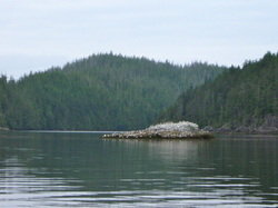
By daylight, the wind was still and the water was flat. Our destination was the very bottom of the Broughton Islands, the edge of the southern tier that is marked by Johnstone Strait. Going to Potts Lagoon meant completing the circumnavigation of Gilford Island, crossing our wake and bending one of our principles of cruising/exploring: going the same way twice. But it could not be helped.
We threaded out of the Fox Group of islands and headed south down Retreat Passage. Again, we saw very few boats. Past Seabreeze Island, our course turned to the southeast, around Henriette Island and into Spring Passage. The chart marks the rocks well as we hugged Gilford Island and entered Knight Inlet. We were fighting a slight ebb current, so the tug was powered up to its fast cruising speed of 3,100 RPM. With the trim tabs fully tipped down, the bow cut through the flat water at almost 12 MPH. Staying out of the main ebb current, our course kept us against the island.
The autopilot on the Laurie Ann is a Raymarine Sportpilot 1000, which has been valuable and reliable. A remote controlled unit that is powered by four AAA batteries controls the pump unit. When the unit began to be sluggish, it occurred to me that I had never changed the batteries since I installed the unit in 2009. Then, the unit just stopped working and that is when I missed not having the autopilot; just like everything, when you cannot have it.
At the eastern point of Turnour Island, we turned to starboard and headed down Clio Channel, seeing Lagoon Cove Marina in the distance for a minute, and now enjoying the ride with nature. We dropped our speed to our fuel sipping, slow cruising speed of 2,000 RPM’s, which is usually about 8 MPH, but the ebbing current carried the tug along at nearly 9 MPH.
At the junction of Beware Passage and Baronet Passage and behind Klaoitsis Island, Potts Lagoon provides a good anchorage in nearly any weather. The lagoon has two arms and we chose the larger one, where we joined three other anchored boats and four floating houses when the Danforth was set in 20 feet with a mud bottom. Like everywhere we had been on this trip, we were the smallest vessel. By sunset, 4 other boats joined us and it was the most crowded anchorage that we experienced on this trip. But by San Juan Island standards, it was not crowded; it’s all a matter of perspective.
A dingy ride took us to an old logging road behind the floating houses and a short walk that ended when the trail turned to mud. Laurie was doing her best to be “bear aware” with her strategy of noisy coins, a walking stick and talking. No bears were seen. Then, we took the dingy to the head of the lagoon where the rising tide opened up a whole other portion. We zipped over large boulders with a foot to spare, going about 3 knots at the narrowest part of the lagoon and entered a quiet and serene bay. Laurie spotted the huge nest made by a bald eagle on the northern shore. We rowed and listened and then when the lagoon shoaled, the motor was started and we headed back. Slack current was an hour away but the 2 HP Honda had the guts to push the dingy through the current, over the boulders and into the main lagoon without incident. Laurie had made cheesecake two days before and we finished the last installment when we got back to the tug, a reward for the explorers.
For the second time, we re-calculated our strategy for tomorrow that involved crossing Johnstone Strait and going to Telegraph Cove. Currents and wind, when done badly can make boating at least, uncomfortable and, at the most, outright dangerous. Johnstone Strait had a well-deserved reputation for nasty conditions, especially when the current and the wind went in opposing directions. We had a departure plan to capture the benefit of the currents but we would wait for tomorrow’s weather report about the winds before executing option A.
Cuba Libra’s in the cockpit and BBQ’d brauts with music from the iPod ended the evening.
Saturday, July 23: Johnstone Strait to Port McNeill & Sointula
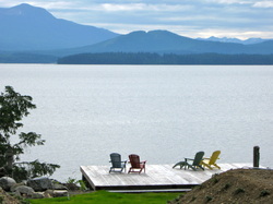
A dewless morning of high clouds and warming temperatures, a hint that summer will actually come to the region. After breakfast, we listened to the weather radio and learned that the winds in Johnstone Strait were light and will be going in the same direction as the current, ebbing out to sea. Killing time while waiting for the departure time to come, we cleaned and did the usual household chores that come with a boat. The anchor was pulled at 0945 hours and we left Potts Lagoon following two trawlers. They continued into Beware Passage but we turned southwest into Baronet Passage. For eight miles, again, we were the only boat in sight. The current was with us down this Passage as 2,000 RPM took us at 10.5 MPH. The narrow, but deep neck at the western point of Klaoitsis Island made us hold our breath but it really was a nothing. The passage is simply that, a method of getting from one place to another, it is not a place to seek anchorage or shelter.
Ahead of schedule, we flew to the point of West Cracroft Island, avoided the well-marked rocks, eased past a cluster of small sport fishing boats looking for salmon and entered Johnstone Strait. This one place that all boats, commercial and recreational, all come together; from cruise ships to small fishing boats and then add a pack of Orca whales with the required sightseeing boats and you have traffic.
We immediately encountered a huge tug pulling a monster barge using the ebbing current to come our way. But when our little tug was powered up to 3,100 RPM, we created that safe distance that the commercial pilots like to see. Johnstone Strait was safe but it was far from being a lake, it was the most active water we had on this trip. Current and wind created a close two-foot chop that pushed on our transom as we angled across the strait and up the southern side to Telegraph Cove. It was active steering to ride the swells and keep the bow in the desired direction.
Telegraph Cove, on Vancouver Island, is a very small cove with two ramps, and rimmed with buildings on pilings. The cove is a maze of slips with the longest being 30 feet. With no answer on VHF 66, Laurie used the cell phone to call the harbormaster. We idled at the entrance waiting for the executive decision on where to put a 25-foot boat among the 50 or so empty slips. This decision was apparently above the employee’s pay grade. Not impressed with the initial customer service, we took our assigned slip and docked under the approving gaze of a small crowd. $6 dollars to stay for two hours, $7 to launch a boat and $60 to store a vehicle there for two weeks, made Port McNeill the wise choice for us. Plus, there is no store for last minute provisioning. But the lunch we bought was good and the history of the town, the whale museum, and listening to all the foreign languages spoken, made the place an interesting visit.
An hour later, we decided to keep going to Port McNeill, only 13 miles away. The Strait was still active until we past Alert Bay and then it was flat and calm from the protection afforded by Malcolm Island. The tug was running like a Swiss watch as we approached our starting place. Laurie called ahead to the harbormaster, who found us one of the few available spots in the marina; there is always room for a 25 footer. After docking, we plugged in for the first time since Lagoon Cove.
An hour later, we were walking on the ferry to Sointula, the only town on Malcolm Island that is of Finnish origin, settled by coal miners who were treated badly near Nanaimo at the turn of the 20th century. We walked the 1.5 miles to the boat basin, admired the houses along the way, had fish & chips at the Burger Barn, and found the museum opened and staffed by a 14 year old. We had ice cream on the wharf while waiting for the ferry for the return trip.
